St Johannes de Doperkerk in Maldingen
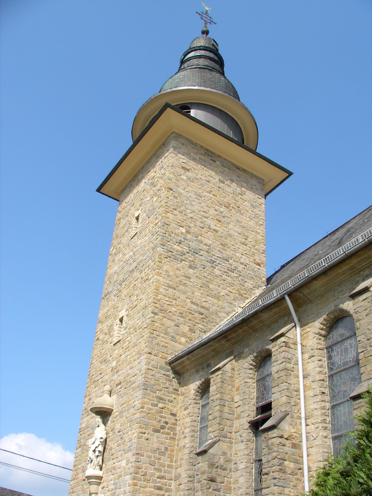
De kerk in Maldingen, die in 1926 werd ingewijd door de toenmalige hulpbisschop van Luik, de heer Kerkhofs, werd gebouwd naar een ontwerp van de architect Cunibert uit Malmedy. De huidige kerk staat op de plaats van een kapel gewijd aan Sint Jan, die voor het eerst werd vermeld in de parochiearchieven van Aldringen in 1688 en werd vervangen door een nieuw gebouw in 1776. Het uit natuursteen opgetrokken gebouw bestaat uit drie schepen die onder één dak verenigd zijn. De 50 meter hoge toren wordt bekroond door een rond, trapsgewijs helmdak. Deze bouwmethode is typisch voor Cunibert en de kerk die hij in Medell bouwde heeft ook een uienkoepel.
Binnen in de kerk zijn het stergewelf en het glazen roosvenster indrukwekkend. De altaren, de communiebank en het wijwatervont zijn neoromaans en gemaakt van zwart en witbruin marmer.
Op de achtermuur onder het orgel is een nis van een barokaltaar met een beeld van de evangelist Mattheüs, dat waarschijnlijk uit de oude kapel komt. Op de rechter biechtstoel staat een engel met een trompet; het was onderdeel van een preekstoel die in de kerk van de Luxemburgse grensstad Weiswampach stond.
Bron: Kerken en kapellen in Oost-België door Freddy Derwahl en Johannes Weber

The old village watering place
")